Check out our Top Rewards Cards to boost your points earning and travel more!
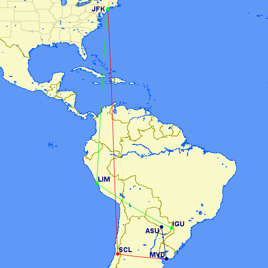
Reader Kay requested better detail on itineraries, so step one was cribbing from blogging studs Wandering Aramean and One Mile at a Time on how to use Great Circle Mapper.
Details to follow, time for SCL-MVD!
Check Out Our: Top Rewards Cards ¦ Newsletter ¦ Twitter ¦ Facebook ¦ Instagram


@Seth – the word from the master, thanks so much, I can look like one of the big bloggers now. 🙂
A couple suggestions…
1) Add &PW=3 to the end of the URL. It makes the lines a bit heavier and easier to see on the map.
2) You can specify locations via lat/lon rather than IATA/ICAO codes: http://www.gcmap.com/faq/locations#latlon.
3) When the time comes to embed the map, just use the URL to the image straight from the GCMap.com servers. That’s their preference for how the data is served up.
4) Have a great trip!
@aptraveler – I will be happy to revisit old jaunts. I need to figure out a way to represent the overland aspects of a trip, which are critical to me. I can fudge it with cities that have airports but may need a different tool.
Wow! Thanks for the visual. Enjoy your vacay… I can’t wait to hear the full trip report
Great addition to your site. Maybe you can do the same with your previous trips, so as to have a better visual on the creative routes you took. Your other SA trip comes to mind. Have fun!
You are a workaholic, Mr. RTC :D. I didn’t bring my laptop. Enjoy your trip!